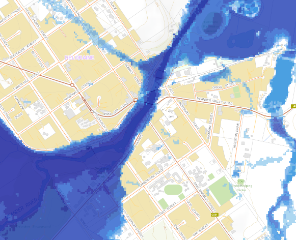
Huon Valley Council welcomes the release of the new Tasmanian Strategic Flood Maps, a significant step in helping communities better understand and prepare for flood risk.
Developed by the State Emergency Service (SES), the maps show the probable extent of flooding and how deep and fast water may be moving under a range of scenarios.
While some areas are still being mapped and those subject to flash flooding may not be reflected in the exercise. This release lays the groundwork for stronger flood preparedness and planning.
Residents whose properties fall within mapped flood-prone areas are encouraged to take action to keep themselves safe and reduce flood damage.
Informed by the mapping project, there are Community Protection Flood Guides for specific communities within the Huon Valley that explain local flood risks and can help guide preparatory action.
Mayor Sally Doyle encouraged all residents, businesses and landowners to explore the maps and use the information to make informed decisions.
“Floods are part of life in the Huon Valley, and with the increasing severity of rainfall events, it’s more important than ever to be prepared. These maps are a valuable resource for knowing your local risk, making safer choices, and protecting the things you care about,” Mayor Doyle said.
Council will use the flood mapping data to:
- incorporate into land use planning to reduce risk and guide long-term responsible and sustainable development
- prioritise the development of detailed local flood studies to bridge the knowledge gaps.
- inform and prioritise infrastructure renewal and upgrade works
- inform and prioritise our community resilience work and disaster preparedness.
Access the maps online:
www.ses.tas.gov.au/floodmaps or www.thelist.tas.gov.au
For local flood guides and preparedness information, visit Council’s Emergency Management Hub:
Community Protection Flood Guides – Huon Valley Council