Huon Valley residents can now access detailed bushfire risk information for their individual properties through a new online platform that helps households make more informed bushfire preparedness plans.
The Greater Hobart Bushfire Exposure Index – already in use by Clarence, Derwent Valley, Hobart and Kingborough residents – now includes the Huon Valley, giving southern Tasmania consistent, evidence-based information to support community safety and preparedness.
“We know that bushfire is one of the greatest challenges our community faces,” Mayor Sally Doyle said. “This new tool gives residents more information to understand their own level of risk and plan ahead.”
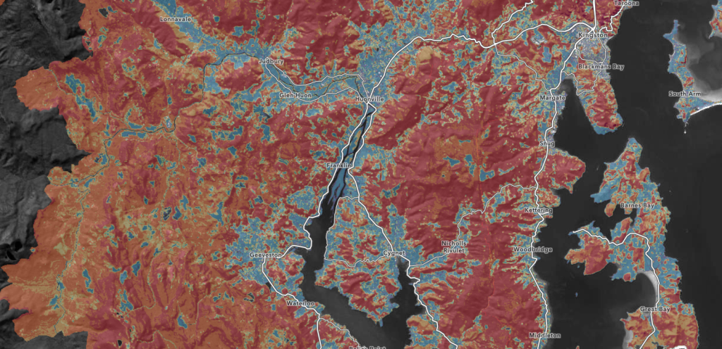
The Index, developed by Geoneon, uses vegetation mapping and other spatial data to assign a bushfire exposure rating for each property. While the tool does not predict where a bushfire will start, it highlights the potential intensity of a fire in the area.
“Residents can search their address to view their property’s exposure rating and use that information to update their household bushfire plan, assess risk along nearby roads to plan safe exit routes, and prioritise vegetation maintenance activities” Mayor Doyle said.
Residents are encouraged to use the new tool alongside other preparedness resources including the Tasmania Fire Service’s Bushfire: Why Risk It? portal, TasALERT, and Council’s Emergency Management Hub, available at www.huonvalley.tas.gov.au/emergency-information
For more information or to explore the new map, visit www.huonvalley.tas.gov.au/greater-hobart-bushfire-exposure-index
ENDS